Terrain Solar Radiation
Terrain/Texturing
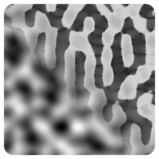
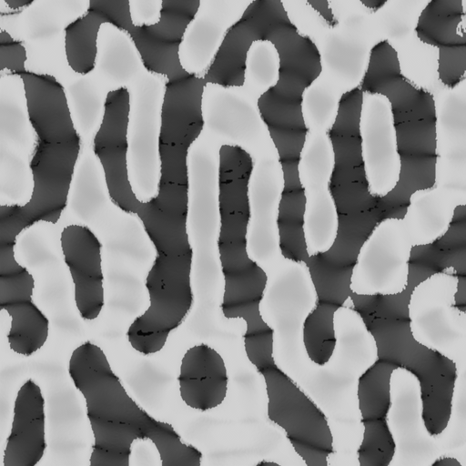
The node computes the amount of sunlight a terrain receives based on its geometry and geographical parameters. This can be used for simulating climate-driven phenomena, vegetation growth, and terrain shading patterns. it calculates solar exposure by simulating the sun's path across the sky for a specific day of the year, latitude, and terrain orientation.
Input Parameters
- SampleCount Uint
- Height Image Gray
- PhysicalSize Float
- PhysicalHeight Float
- DayOfTheYear Uint
- Orientation Float
- Latitude Float
Output Parameters
- Output Image Gray
Example
Meta
| Author | InstaMaterial GmbH | Category | Terrain/Texturing | Tooltip | The node computes the amount of sunlight a terrain receives based on its geometry and geographical parameters. This can be used for simulating climate-driven phenomena, vegetation growth, and terrain shading patterns. it calculates solar exposure by simulating the sun's path across the sky for a specific day of the year, latitude, and terrain orientation. | Name | Terrain Solar Radiation | Version | 1.15 | ID | 56ad1f04-8b20-4af5-ad29-a433813ac59a | PackageUrl | pkg://c40ab07a-fbe6-4e0c-9513-62732d845b7d/atoms/56ad1f04-8b20-4af5-ad29-a433813ac59a.atom |
|---|