Terrain Ramp
Terrain/Texturing
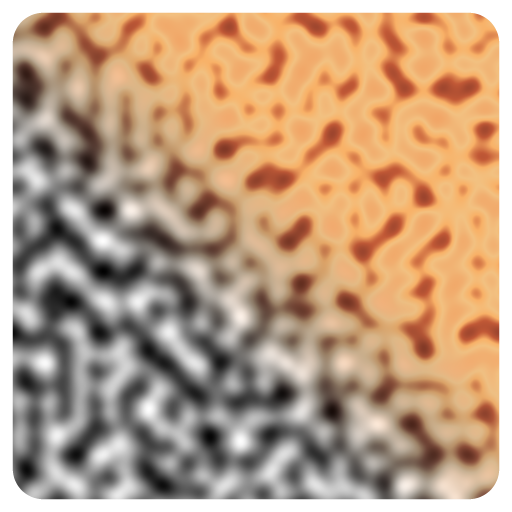
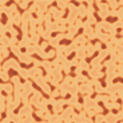
Can be used to apply color gradients (i.e. ramps) to terrains based on height, slope, or other scalar maps. It's primarily used for terrain texturing, enabling the creation of visually rich and informative surfaces. It allso has predefined color ramps based on real-world satellite data from various landscapes.
Input Parameters
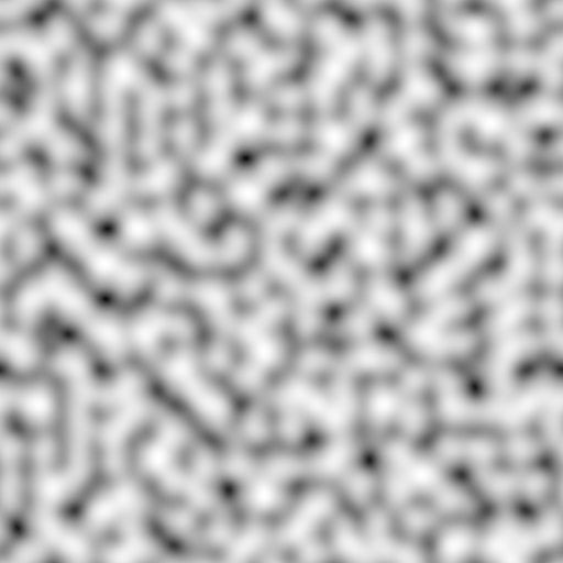
- Input Image Gray
- Category Enum
- GISCategory Enum
- BlueCategory Enum
- GreenCategory Enum
- BrownCategory Enum
- SatelliteCategory Enum
- Balance Float
- Range Vec2
- Offset Float
- SamplingMode Enum
- HSL Boolean
- Hue Float
- Saturation Float
- Luminosity Float
- Reverse Boolean
- InputAutoLevel Boolean
- RampOutput Boolean
Mask
- Threshold Float
- Softness Float
- InvertMask Boolean
Noise
- Jitter Float
- JitterNoise Enum
- JitterScale UVec2
- JitterSoftness Float
Output Parameters
- Output Image
- Mask Image Gray
- Ramp Image
Example
Meta
| Author | InstaMaterial GmbH | Category | Terrain/Texturing | Tooltip | Can be used to apply color gradients (i.e. ramps) to terrains based on height, slope, or other scalar maps. It's primarily used for terrain texturing, enabling the creation of visually rich and informative surfaces. It allso has predefined color ramps based on real-world satellite data from various landscapes. | Name | Terrain Ramp | Version | 1.54 | ID | c5285a9d-6d22-4423-be30-85ccfdd45583 | PackageUrl | pkg://73af8542-bd72-433d-8268-e748da18bd3e/atoms/c5285a9d-6d22-4423-be30-85ccfdd45583.atom |
|---|